Public domain
NASA's ECOSTRESS Maps Europe Heat Wave
From the collection of NASA Image and Video Library. Free to download, adapt and use — no permission needed.
About this work
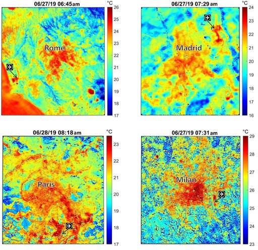
These maps of four European cities show ECOSTRESS surface temperature images acquired in the early mornings of June 27 and 28, 2019, during a heatwave. The images have been sharpened to delineate key features such as airports. Airports and city centers are hotter than surrounding regions because they have more surfaces that retain heat (asphalt, concrete, etc.). ECOSTRESS launched on June 29, 2018, as part of a SpaceX commercial resupply mission to the International Space Station.
NASA Image and Video Library’s own descriptionCredit lineNASA's ECOSTRESS Maps Europe Heat Wave. NASA/JPL, 2019-07-02. Public domain. ID: PIA23148.