Public domain
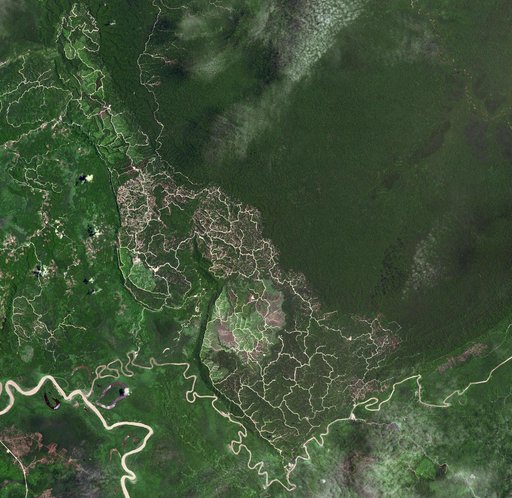
Brunei-Sarawak Border
From the collection of NASA Image and Video Library. Free to download, adapt and use — no permission needed.
About this work
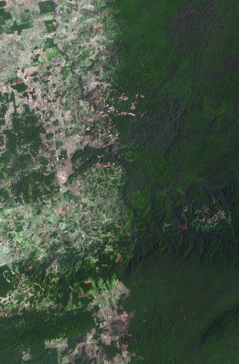
The southwestern border of Brunei with Sarawak, Malaysia is strikingly apparent due to differences in land use practice. On the Malaysian side, a spider web of small roads indicates intensive land use: in this case clearing of the forest for palm oil plantations. On the Brunei side, the virgin forest is preserved, with few if any roads cutting through the forest. The image was acquired September 10, 2012, covers an area of 38 by 38 km, and is located at 4.2 degrees north, 114.4 degrees east.
NASA Image and Video Library’s own descriptionCredit lineBrunei-Sarawak Border. NASA/JPL, 2017-10-31. Public domain. ID: PIA22034.