Public domain
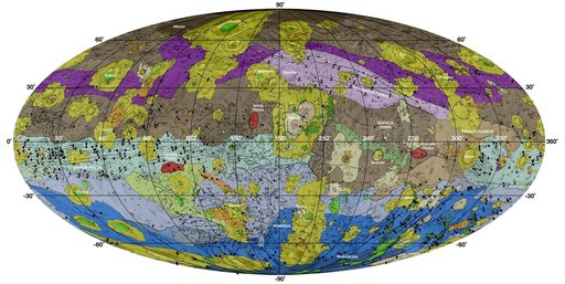
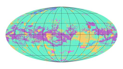
First Global Geologic Map of Titan
From the collection of NASA Image and Video Library. Free to download, adapt and use — no permission needed.
About this work
The first global geologic map of Saturn's largest moon, Titan, is based on radar and visible and infrared images from NASA's Cassini mission, which orbited Saturn from 2004 to 2017. Black lines mark 30 degrees of latitude and longitude. Map is in Mollweide projection, a global view that attempts to minimize the size or area distortion, especially at the poles (although shapes are increasingly distorted away from the center of the map).
NASA Image and Video Library’s own descriptionSubjects
Credit lineFirst Global Geologic Map of Titan. NASA/JPL, 2019-11-18. Public domain. ID: PIA23174.