Public domain
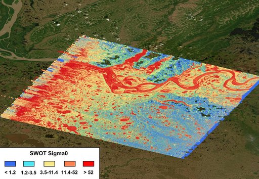
SWOT Captures the Yukon River in Alaska
From the collection of NASA Image and Video Library. Free to download, adapt and use — no permission needed.
About this work
The mighty Yukon River and nearby lakes appear in red in this image produced using data recorded on June 18, 2023, by the international Surface Water and Ocean Topography (SWOT) satellite as it passed over Alaska. The satellite measures the height of nearly all the water on Earth's surface, providing one of the most detailed, comprehensive views yet of the planet's ocean and fresh water.
NASA Image and Video Library’s own descriptionSubjects
Credit lineSWOT Captures the Yukon River in Alaska. NASA/JPL, 2023-08-30. Public domain. ID: PIA25780.