Public domain
NASA's EMIT Collects Data on Mid-Atlanic Plant Communities
From the collection of NASA Image and Video Library. Free to download, adapt and use — no permission needed.
About this work
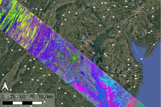
Data collected by NASA's Earth Surface Mineral Dust Source Investigation (EMIT) on April 23, 2024, indicates the location of a variety of planet communites across a swath of the mid-Atlantic United States. Overlain on a Google base map, each color represents a different type of natural biome or agricultural land. Hyperspectral data such as this is being analyzed in a range of NASA-funded research projects looking at the distribution and traits of plant communities, including agricultural crops.
NASA Image and Video Library’s own descriptionCredit lineNASA's EMIT Collects Data on Mid-Atlanic Plant Communities. NASA/JPL, 2024-11-14. Public domain. ID: PIA26418.