Public domain
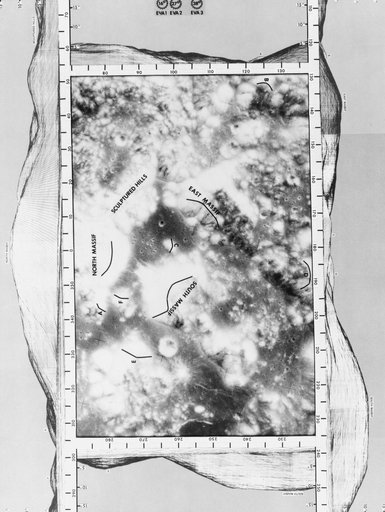
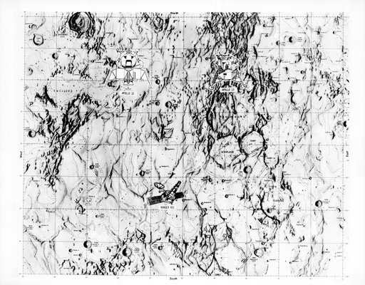
Map - Lunar Samples
From the collection of NASA Image and Video Library. Free to download, adapt and use — no permission needed.
About this work
S70-28115 (January 1970) --- This overlay map of terrain on the lunar nearside shows the area of the landing site of the upcoming Apollo 13 mission, in relation to two previous NASA landings. The proposed Apollo 13 landing site is located in the highlands north of Fra Mauro. The coordinates of the planned site are 17.550 degrees west longitude and 3.617 degrees south latitude. The landing site of the Apollo 12 mission, which was highlighted by a lunar landing on Nov.
NASA Image and Video Library’s own descriptionCredit lineMap - Lunar Samples. NASA/JSC, 1970-12-18. Public domain. ID: S70-28115.