Public domain
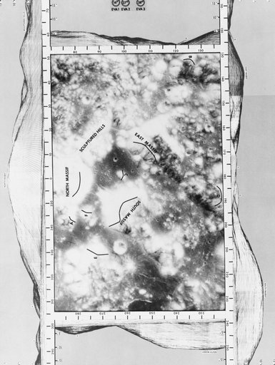
LANDING SITE - APOLLO 17 (MAP)
From the collection of NASA Image and Video Library. Free to download, adapt and use — no permission needed.
About this work
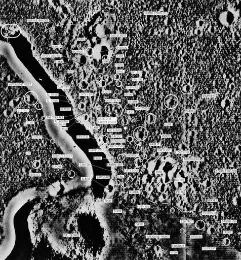
S72-54413 (December 1972) --- A vertical view of the Taurus-Littrow landing area photographed on an earlier Apollo mission from lunar orbit. The mission photograph is surrounded on all sides by a computer-generated 360-degree panorama of the region as seen by an observer at the nominal Apollo 17 Lunar Module landing site. The 360-degree panorama is divided into four sections, north-east-south-west. Each section includes an overlap of about 15 degrees with each adjacent section.
NASA Image and Video Library’s own descriptionCredit lineLANDING SITE - APOLLO 17 (MAP). NASA/JSC, 1972-12-05. Public domain. ID: S72-54413.