Public domain
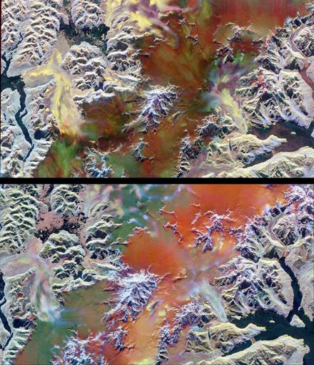
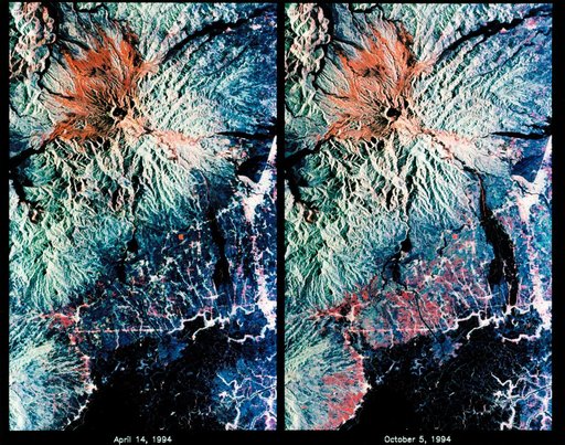
STS-68 radar image: Mt. Pinatubo, Philippines
From the collection of NASA Image and Video Library. Free to download, adapt and use — no permission needed.
About this work
STS068-S-053 (7 October 1994) --- These are color composite radar images showing the area around Mount Pinatubo in the Philippines. The images were acquired by the Spaceborne Imaging Radar-C/X-Band Synthetic Aperture Radar (SIR-C/X-SAR) aboard the Space Shuttle Endeavour on April 14, 1994 (left image) and October 5, 1994 (right image). The images are centered at about 15 degrees north latitude and 120.5 degrees east longitude. Both images were obtained with the same viewing geometry.
NASA Image and Video Library’s own descriptionCredit lineSTS-68 radar image: Mt. Pinatubo, Philippines. NASA/JSC, 1994-10-07. Public domain. ID: sts068-s-053.