Public domain
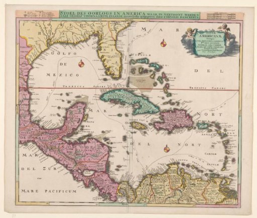
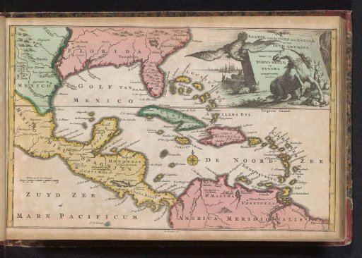
Map of the Gulf of Mexico
From the collection of Rijksmuseum, Amsterdam. Free to download, adapt and use — no permission needed.
About this work
Map of the countries located on the Gulf of Mexico, with a vignette in the upper right showing a (English) unicorn that has broken its chain and holds a ram under its hoof, an eagle in the sky. Also some rabbits. Probably in connection with the theatre of war of the War of the Spanish Succession. Part of an atlas with 223 maps of countries and cities and scenes of war in Europe in the period c. 1690-1735.
Rijksmuseum, Amsterdam’s own descriptionCredit lineKaart van de Golf van Mexico. 1735. Balthasar Ruyter. Rijksmuseum, Amsterdam. Public domain.