Public domain
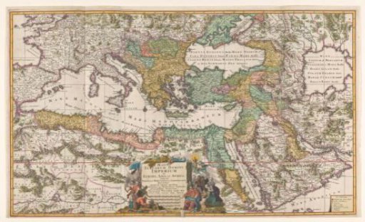
Map of the Ottoman Empire
From the collection of Rijksmuseum, Amsterdam. Free to download, adapt and use — no permission needed.
About this work
Map of the Mediterranean region with parts of Europe, Africa and Asia, with the borders of the Ottoman Empire indicated around 1680. To the left of the title cartouche soldiers leading a prisoner. A kneeling man offers gifts to the sultan. On the right a scene in which conversion to Islam is presented. Two men kneel before an open book, probably the Bible. The figure holding the book points them to an image of Mohammed held by a devil.
Rijksmuseum, Amsterdam’s own descriptionCredit lineKaart van het Ottomaanse Rijk. 1682 - 1702. Gilliam van der Gouwen. Rijksmuseum, Amsterdam. Public domain.