Public domain
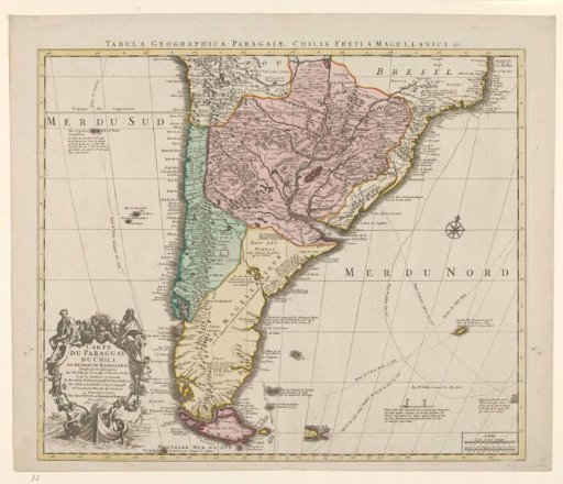
Map of the southern part of South America
From the collection of Rijksmuseum, Amsterdam. Free to download, adapt and use — no permission needed.
About this work
Map of the southern part of South America with the current countries Argentina, Uruguay, Paraguay, and Chile. Yellow-bordered, titles at the top in Latin and at the bottom left in a cartouche in French. Cartouche carried by a boat with two rowers, surrounded by allegorical figures. At the middle right, compass rose; at the bottom right, scale in Spanish sea and ordinary miles.
Rijksmuseum, Amsterdam’s own descriptionCredit lineKaart van het zuidelijke deel van Zuid-Amerika. 1750 - 1760. Guillaume Delisle. Rijksmuseum, Amsterdam. Public domain.