Public domain
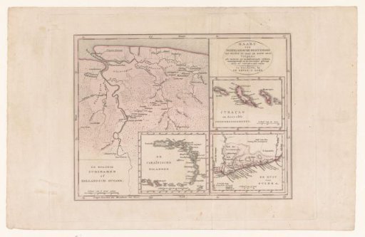
Map of Suriname with the Caribbean, Curaçao and West Africa
From the collection of Rijksmuseum, Amsterdam. Free to download, adapt and use — no permission needed.
About this work
Four maps on one sheet, the main map Suriname. Also an inset of the Caribbean Islands (Aruba to Puerto Rico), an inset of Aruba, Curaçao and Bonaire, and an inset of the Dutch possessions in West Africa (modern Ghana). Border coloring on the main map.
Rijksmuseum, Amsterdam’s own descriptionCredit lineKaart van Suriname met Caraïben, Curaçao en West-Afrika. 1776 - 1851. Daniël Veelwaard (I). Rijksmuseum, Amsterdam. Public domain.