Public domain
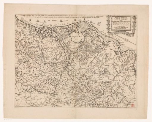
Map of the Netherlands with the war situation of 1672-73
From the collection of Rijksmuseum, Amsterdam. Free to download, adapt and use — no permission needed.
About this work
Map of the Netherlands. On the map a line is drawn indicating which areas the Republic lost to France and her allies in 1672 and which areas remained. In the upper right the title cartouche surrounded by the provincial coats of arms. Below the cartouche a scale: 15 Dutch miles / 20 Hours of Travel.
Rijksmuseum, Amsterdam’s own descriptionCredit lineKaart van de Nederlanden met de oorlogssituatie van 1672-73. 1672. anonymous. Rijksmuseum, Amsterdam. Public domain.