Public domain
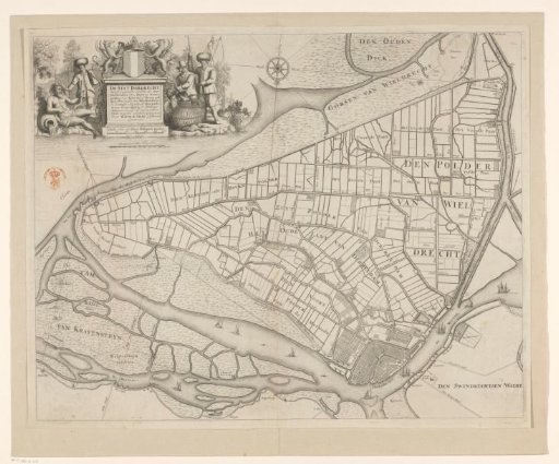
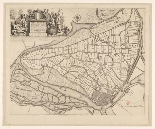
Map of Dordrecht and surrounding polders
From the collection of Rijksmuseum, Amsterdam. Free to download, adapt and use — no permission needed.
About this work
Map of Dordrecht and surrounding polders. The title cartouche is at the top left, with the coat of arms of Dordrecht above it and a scale bar below: Schale van 300 Zuyt Hollantse roeden. To the left is a river god and a fisherman, and to the right a goose hunter and a fisherman.
Rijksmuseum, Amsterdam’s own descriptionCredit lineKaart van Dordrecht en omliggende polders. 1673. Bastiaen Stopendael. Rijksmuseum, Amsterdam. Public domain.