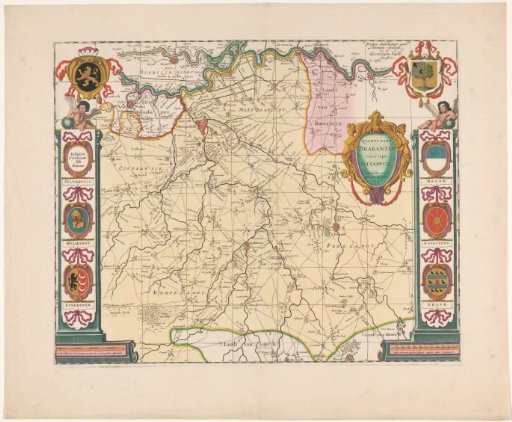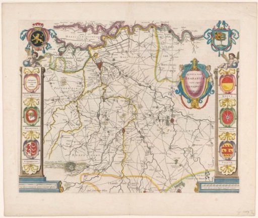
Map of the Meierij of 's-Hertogenbosch
From the collection of Rijksmuseum, Amsterdam. Free to download, adapt and use — no permission needed.
Map of the Meierij of 's-Hertogenbosch. In the upper left, the coat of arms of Brabant. In the upper right, the coat of arms of 's-Hertogenbosch. On the left and right, pilasters with putti sitting on them. Hanging over the pilasters are banners, each bearing three coats of arms. In the upper shield on the left banner is the text: Insignia Civitatum sub ditione. Below, the coats of arms of Helmond and Eindhoven. On the right banner are the coats of arms of Megen, Ravenstein, and Grave. To the left of the right pilaster is the title cartouche. In the lower left, a scale bar: 2 Scala milliarium Germanicorum quorum 15 uni gradui respondent. In the lower right, a scale bar: 2400 Scala virgarum quarum singulae viginti pedes continent. On the verso, Dutch text.
Rijksmuseum, Amsterdam’s own description