Map of Actual and Royal Flanders
From the collection of Rijksmuseum, Amsterdam. Free to download, adapt and use — no permission needed.
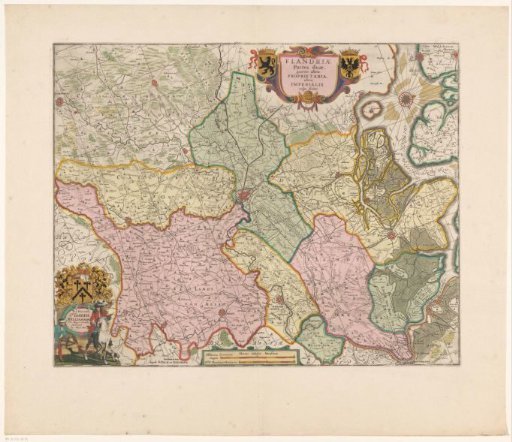
Map of Proper and Imperial Flanders. Within the area belonging to the Holy Roman Empire (Imperial Flanders) were also the lordships of Bornem, Dendermonde and Geraardsbergen, which were in full possession of the Count of Flanders and were designated as 'Proper Flanders' or 'Eigene'. Top, right of center: the title cartouche. Left of the cartouche: the coat of arms of Flanders. Right: a shield with the double-headed eagle of the Holy Roman Empire, with a heart shield bearing the Flemish lion. Bottom left: a cartouche with a dedication to Joseph Williamson, with his coat of arms above the cartouche. Bottom center: a cartouche with two scale bars: Milliarica Germanica magna / Mill. Flandrica et Brabantica. The map is provided with a coordinate grid.
Rijksmuseum, Amsterdam’s own description