Public domain
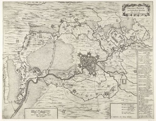
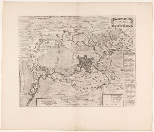
Map of the siege of Breda, 1624
From the collection of Rijksmuseum, Amsterdam. Free to download, adapt and use — no permission needed.
About this work
Map of the siege of Breda by the Spanish army under Spinola, 27 August 1624 to 5 June 1625. With the encirclement of the city and all forts of the besieging troops and the army camps. In the upper right the title cartouche. In the lower right a cartouche with the legend 1-43, to the left of it a cartouche with the legend 44-48, both in French. Below, left of the center, a cartouche with scale bar: Eschelle de mille pas geometriques / Scala di passi geometri mille, die piedi cinque per passi. With Latin text on the verso.
Rijksmuseum, Amsterdam’s own descriptionCredit lineKaart van het beleg van Breda, 1624. 1652. anonymous. Rijksmuseum, Amsterdam. Public domain.