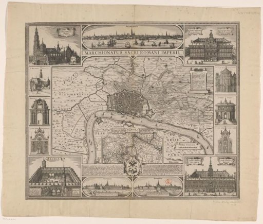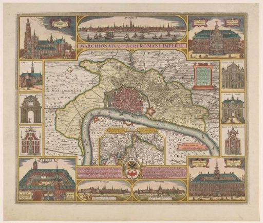
Map of the City of Antwerp and its Surroundings
From the collection of Rijksmuseum, Amsterdam. Free to download, adapt and use — no permission needed.
Plan of the city of Antwerp and its surroundings. In the lower right, a cartouche with a scale bar: 2000 Passus Communes. Below, in the center, an inset with a map of the course of the Scheldt. Below the inset, the coat of arms of Antwerp, with Latin text on the left and Dutch text on the right. Above, in the center, a view of Antwerp from the Scheldt. Below, to the left of the center, a view of Antwerp from the direction of Zevenbergen and Breda. Below, to the right of the center, a view of Antwerp from the direction of Mechelen and Brussels. Along the left side of the map, from top to bottom, views of the Cathedral of Our Lady, the Abbey of Saint Michael, the Mariaport, the Saint Augustine Church, and the Stock Exchange, in Antwerp. Along the right side of the map, from top to bottom, views of the Town Hall, the Saint Charles Borromeus Church, the Saint George's Gate, the Church of the Brothers of Our Lady, and the Oosterhuis, in Antwerp.
Rijksmuseum, Amsterdam’s own description