Public domain
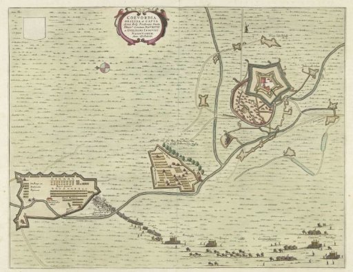
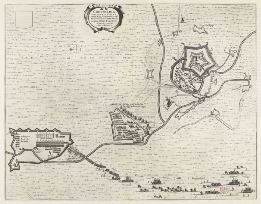
Map of the besieged Coevorden, 1592
From the collection of Rijksmuseum, Amsterdam. Free to download, adapt and use — no permission needed.
About this work
Siege of Coevorden by the States Army under Maurice and William Louis, July–September 1592. Plan of the fortress with Coevorden Castle and the surrounding land with the positions of the besieging troops. At the bottom the Spanish army under Verdugo marches towards the cavalry quarters. Taken from a double-page spread in Blaeu's Stedenboek, printed on both sides with text in Dutch.
Rijksmuseum, Amsterdam’s own descriptionSubjects
Credit lineKaart van het belegerde Coevorden, 1592. 1647 - 1649. anonymous. Rijksmuseum, Amsterdam. Public domain.