Public domain
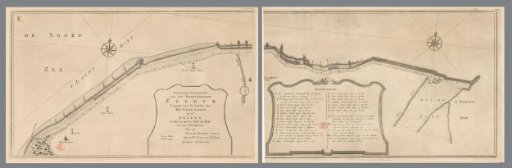
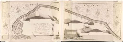
Map of the sea dike east of Muiden, 1737, consisting of two parts
From the collection of Rijksmuseum, Amsterdam. Free to download, adapt and use — no permission needed.
About this work
Map of the sea dike east of Muiden with three profiles of the dike, made after measurements by surveyor Jacob van Hoorn in 1737. In 1735, 1736 and 1737 this dike was reinforced. Left of center a cartouche with the title and explanation. Right of center two scale bars: Scale of 42 rods Rhineland measure (for the map); 42 feet Rhineland work-measure up to ABC (for the profiles).
Rijksmuseum, Amsterdam’s own descriptionSubjects
Credit lineKaart van de zeedijk ten oosten van Muiden, 1737, bestaande uit twee delen. in or after 1737. Hendrik de Leth. Rijksmuseum, Amsterdam. Public domain.