Public domain
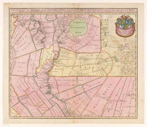
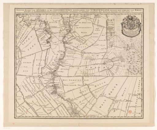
Map of the lordships of Mijnden and both Loosdrecht, 's Gravenland, Breukelen and Loenersloot
From the collection of Rijksmuseum, Amsterdam. Free to download, adapt and use — no permission needed.
About this work
Title along the top edge. In the upper right a cartouche with the dedication and the coat of arms of Jeronimo de Haze. In the lower right of the center a scale bar: Een halv uuren gaans. Degree division along the edges. For many houses indicated on the map, especially along the Vecht and in 's Gravenland, the names of the main residents are also given.
Rijksmuseum, Amsterdam’s own descriptionCredit lineKaart van de heerlijkheden Mijnden en beide Loosdrechten, 's Gravenland, Breukelen en Loenersloot. 1682 - 1702. anonymous. Rijksmuseum, Amsterdam. Public domain.