Public domain
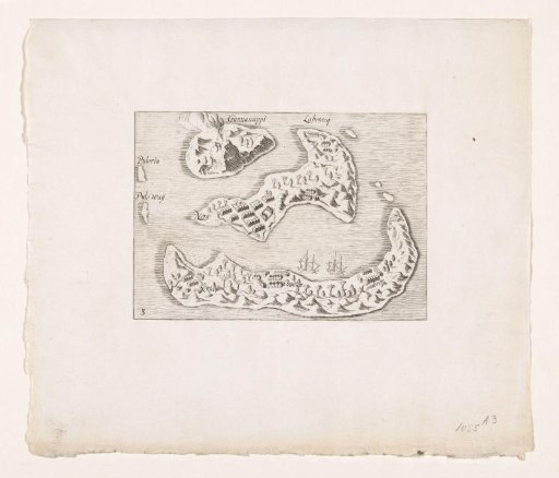
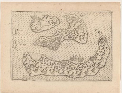
Map of the Banda Islands, 1599
From the collection of Rijksmuseum, Amsterdam. Free to download, adapt and use — no permission needed.
About this work
Map of the Banda Islands in the Moluccas, 1599. Principal supplier of nutmeg and cloves. Part of the illustrations in the travel report of the Second Voyage to the East Indies under Jacob Cornelisz. van Nes and Wijbrant van Warwyck, 1598–1600. No. 15.
Rijksmuseum, Amsterdam’s own descriptionCredit lineKaart van de Banda-eilanden, 1599. 1600 - 1601. anonymous. Rijksmuseum, Amsterdam. Public domain.