Public domain
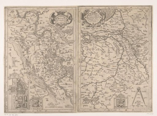
Map of the County of Moers and of the Rhineland, 1610
From the collection of Rijksmuseum, Amsterdam. Free to download, adapt and use — no permission needed.
About this work
Maps of the County of Moers and of the location of the county in the Rhineland. Two separate maps printed on one sheet. On the map of Moers, an inset with a plan of the city of Moers; on the map of the Rhineland, an inset with a plan of Middelaar Castle.
Rijksmuseum, Amsterdam’s own descriptionCredit lineKaart van het graafschap Moers en van het Rijnland, 1610. 1591 - 1595. Joannes Mercator. Rijksmuseum, Amsterdam. Public domain.