Public domain
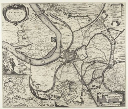
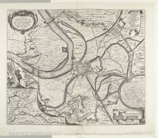
Map of the conquest of Rijnberg, 1633
From the collection of Rijksmuseum, Amsterdam. Free to download, adapt and use — no permission needed.
About this work
Map of the siege and capture of Rijnberg by the States' army under Frederick Henry, 16 May – 2 June 1633. Centrally, the city of Rijnberg on the Rhine, at the bottom the quarters of the stadtholder. Top right, a scroll with the legend 1-20 in Dutch. Bottom left, an inset with a map of the area between Rijnberg and Maastricht with a border featuring fishermen. Taken from a double-page spread in the Stedenboek of Blaeu. Printed on the reverse with text in Latin.
Rijksmuseum, Amsterdam’s own descriptionSubjects
Credit lineKaart van de verovering van Rijnberg, 1633. 1633. Claes Jansz. Visscher (II). Rijksmuseum, Amsterdam. Public domain.