Public domain
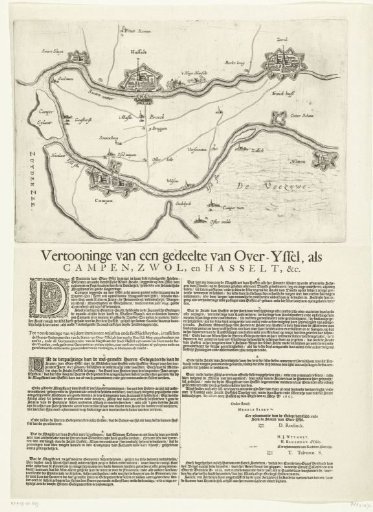
Map of the region between Kampen, Zwolle and Hasselt, 1657
From the collection of Rijksmuseum, Amsterdam. Free to download, adapt and use — no permission needed.
About this work
Map of the region in Overijssel between Kampen, Zwolle and Hasselt, following a treaty between these three cities regarding the leasing of Hasselt's resources, concluded on 29 May 1657. Below the map plate is printed text in two columns with the treaty provisions numbered 1-8.
Rijksmuseum, Amsterdam’s own descriptionCredit lineKaart van de streek tussen Kampen, Zwolle en Hasselt, 1657. 1657. anonymous. Rijksmuseum, Amsterdam. Public domain.