Public domain
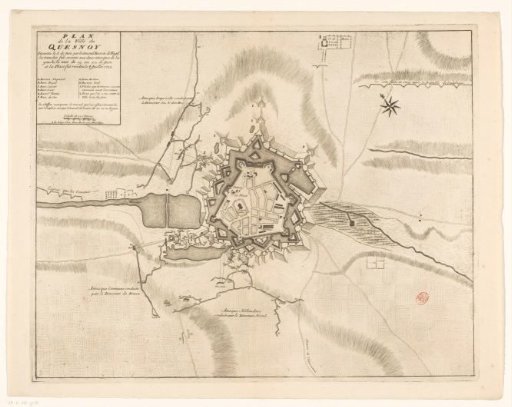
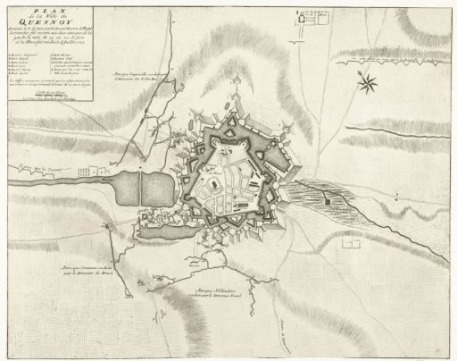
Plan of Le Quesnoy, 1712
From the collection of Rijksmuseum, Amsterdam. Free to download, adapt and use — no permission needed.
About this work
Plan of the fortifications around the town of le Quesnoy, taken by the Allies under Baron Fagel on 6 July 1712, after a siege begun on 8 June. Top left the title cartouche with legend A-L and scale bar: Echelle de 120 Toises.
Rijksmuseum, Amsterdam’s own descriptionSubjects
Credit linePlattegrond van le Quesnoy, 1712. 1712 - 1717. anonymous. Rijksmuseum, Amsterdam. Public domain.