Public domain
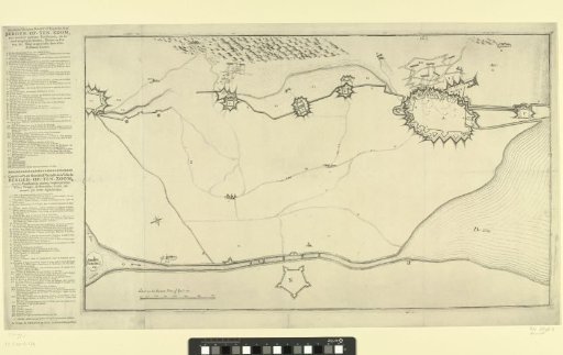
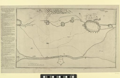
Map with the Fortifications around Bergen op Zoom and Forts in the Surrounding Area
From the collection of Rijksmuseum, Amsterdam. Free to download, adapt and use — no permission needed.
About this work
Map of the siege of the city of Bergen op Zoom by the French army under General Löwenthal, beginning on July 12, 1747. Map showing the fortifications around the city and the nearby forts, with the Scheldt at the bottom. On the sheet to the left of the print, legends A–NN in Dutch and French.
Rijksmuseum, Amsterdam’s own descriptionCredit lineKaart met de versterkingen om Bergen op Zoom en forten in de omgeving. 1747. anonymous. Rijksmuseum, Amsterdam. Public domain.