Public domain
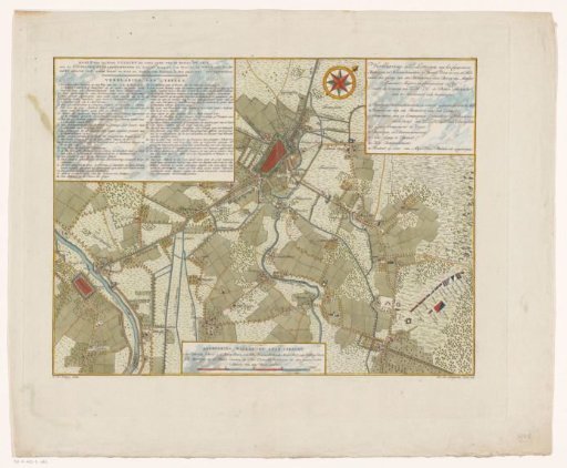
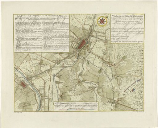
Map of the defense of the city of Utrecht, 1787
From the collection of Rijksmuseum, Amsterdam. Free to download, adapt and use — no permission needed.
About this work
Map of the city of Utrecht and surroundings, up to Vianen, with the batteries and retranchments erected under the leadership of the Rhenish Count of Salm to defend the city against the States army of the stadtholder located at Amersfoort, September 1787. With three cartouches with legends. In the lower cartouche a scale bar: Scale of an hour's walk.
Rijksmuseum, Amsterdam’s own descriptionCredit lineKaart van de verdediging van de stad Utrecht, 1787. 1789. Coenradus Henricus Koning. Rijksmuseum, Amsterdam. Public domain.