Public domain
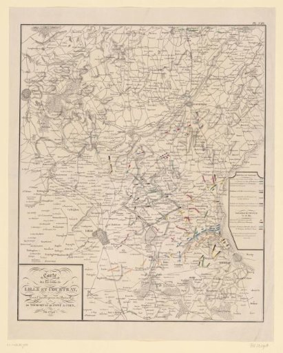
Map of the war area around Lille, Tournai and Courtrai, 1794
From the collection of Rijksmuseum, Amsterdam. Free to download, adapt and use — no permission needed.
About this work
Map of the area between Lille, Tournai and Courtrai, where battles took place on 16 and 22 May 1794 between the French Revolutionary army and the Allies. On the map the positions of the troops are indicated in colors. Numbered top right: Pl. VIII.
Rijksmuseum, Amsterdam’s own descriptionCredit lineKaart van het oorlogsgebied rond Lille, Tournai en Courtrai, 1794. 1800 - 1850. anonymous. Rijksmuseum, Amsterdam. Public domain.