Public domain
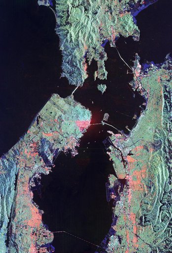
Space Radar Image of San Francisco, California
From the collection of NASA Image and Video Library. Free to download, adapt and use — no permission needed.
About this work
This image of San Francisco, California shows how the radar distinguishes between densely populated urban areas and nearby areas that are relatively unsettled. Downtown San Francisco is at the center and the city of Oakland is at the right across the San Francisco Bay. Some city areas, such as the South of Market, called the SOMA district in San Francisco, appear bright red due to the alignment of streets and buildings to the incoming radar beam.
NASA Image and Video Library’s own descriptionSubjects
Credit lineSpace Radar Image of San Francisco, California. NASA/JPL, 1999-04-15. Public domain. ID: PIA01791.