Public domain
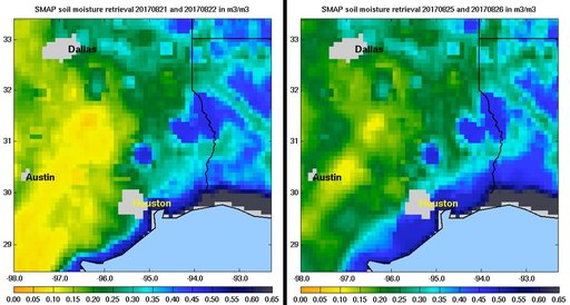
NASA SMAP Images Show Texas Soil Moisture Conditions Before/After Hurricane Harvey's Landfall
From the collection of NASA Image and Video Library. Free to download, adapt and use — no permission needed.
About this work
Images of soil moisture conditions in Texas near Houston, generated by NASA's Soil Moisture Active Passive (SMAP) satellite before and after the landfall of Hurricane Harvey can be used to monitor changing ground conditions due to Harvey's rainfall. As seen in the left panel, SMAP observations show that soil surface conditions were already very wet a few days before the hurricane made landfall (August 21/22), with moisture levels in the 20 to 40 percent range.
NASA Image and Video Library’s own descriptionSubjects
Credit lineNASA SMAP Images Show Texas Soil Moisture Conditions Before/After Hurricane Harvey's Landfall. NASA/JPL, 2017-08-29. Public domain. ID: PIA21926.
Similar works
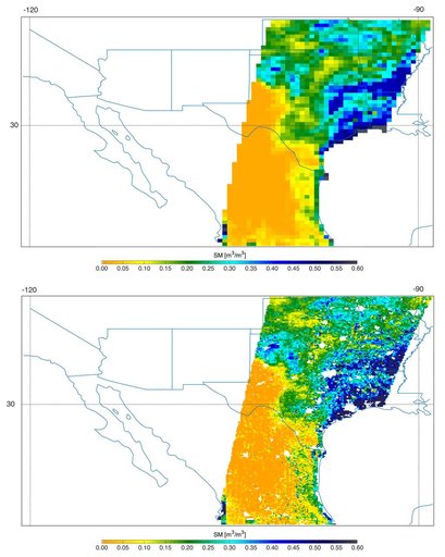 Southern U.S. Soil Moisture Map
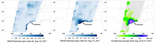 Surface Flooding from Hurricane Harvey Shown in New SMAP Imagery
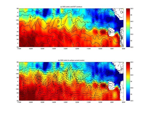 NASA Aquarius Maps Ocean Salinity Structure
 Hurricane Emily
 New NASA Maps Show Flooding Changes In Aftermath of Hurricane Harvey
 NASA's AIRS Instrument Tracks Volcanic Sulfur Dioxide Plume from Mauna Loa Eruption