Public domain
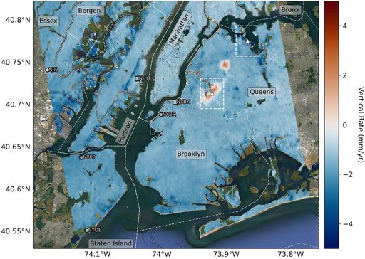
Hot Spots of Subsidence, Uplift in New York City
From the collection of NASA Image and Video Library. Free to download, adapt and use — no permission needed.
About this work
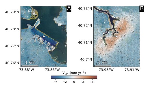
Using radars on the ESA (European Space Agency) Sentinel-1 satellites, along with advanced data processing techniques, a team of researchers measured upward and downward vertical land motion – also known as uplift and subsidence – across the New York City metropolitan area from 2016 to 2023. They mapped the motion in detail and pinpointed specific locations seen here – an airport runway and part of a Superfund site – that were notably sinking or rising.
NASA Image and Video Library’s own descriptionSubjects
Credit lineHot Spots of Subsidence, Uplift in New York City. NASA/JPL, 2023-09-27. Public domain. ID: PIA25528.