Public domain
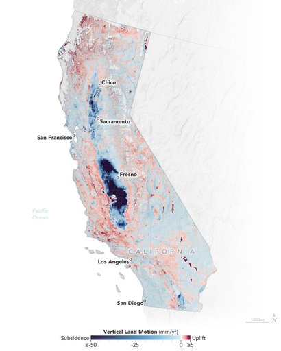
Map of California Subsidence and Uplift
From the collection of NASA Image and Video Library. Free to download, adapt and use — no permission needed.
About this work
Researchers from NASA's Jet Propulsion Laboratory in Southern California and the National Oceanic and Atmospheric Administration (NOAA) analyzed vertical land motion – also known as uplift and subsidence – along the California coast between 2015 and 2023. They detailed where land beneath major coastal cities, including parts of San Francisco, Los Angeles, and San Diego, is sinking (indicated in blue in this visualization of the data). Locations of uplift (shown in red) were also observed.
NASA Image and Video Library’s own descriptionSubjects
Credit lineMap of California Subsidence and Uplift. NASA/JPL, 2025-02-10. Public domain. ID: PIA25530.