Public domain
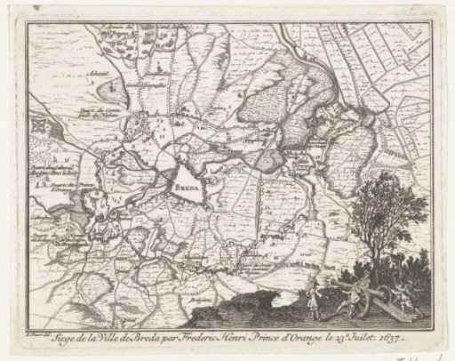
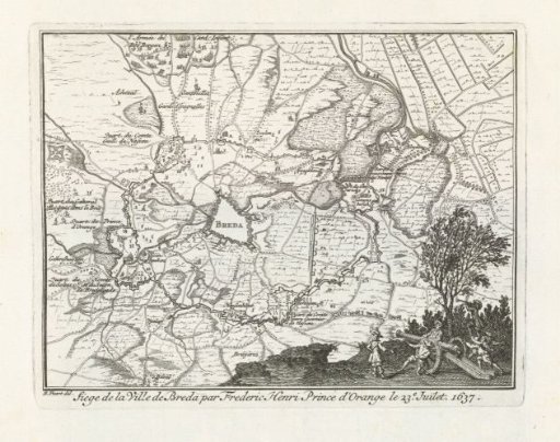
Map of the siege of Breda by Frederik Hendrik, 1637
From the collection of Rijksmuseum, Amsterdam. Free to download, adapt and use — no permission needed.
About this work
Map of Breda and the surrounding land during the encirclement and siege by the States' army under Frederick Henry, 23 July – 10 October 1637. Foreground: soldiers with a cannon. This plate printed together with another plate on a single sheet.
Rijksmuseum, Amsterdam’s own descriptionSubjects
Credit lineKaart van het beleg van Breda door Frederik Hendrik, 1637. 1732 - 1733. Bernard Picart. Rijksmuseum, Amsterdam. Public domain.