Public domain
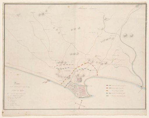
Map of the Attack on Elmina, 1828
From the collection of Rijksmuseum, Amsterdam. Free to download, adapt and use — no permission needed.
About this work
Map of the coastal area of Guinea (Ghana) around Elmina and part of the hinterland. On the right a river. On the peninsula buildings are indicated including the fort Sint George. In the interior roads are drawn with adjacent places. Furthermore, mountains are indicated with grey circles. On the map is the position of the armies of the Dutch and the Ashanti (Asante) who attacked Elmina in October 1828. Bottom left the legend with numbers of the seven buildings and mountains. Bottom right the legend of the two armies on 1, 2 and 19 October 1828.
Rijksmuseum, Amsterdam’s own descriptionCredit lineKaart van de aanval op Elmina, 1828. 1828. H.W.A. van Rappard. Rijksmuseum, Amsterdam. Public domain.