Public domain
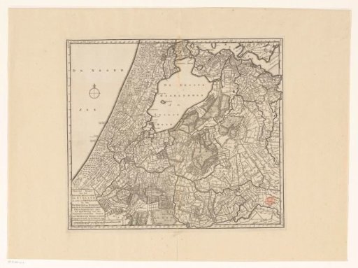
Map of Rijnland, Amstelland and the Waterschap of Woerden
From the collection of Rijksmuseum, Amsterdam. Free to download, adapt and use — no permission needed.
About this work
Map of the Rijnland and Amstelland Water Boards and the Woerden Water District. In the lower left, the title cartouche and a scale rod: 3000 Rynlandse roeden or 2 uuren gaans. Degree divisions along the edges.
Rijksmuseum, Amsterdam’s own descriptionCredit lineKaart van Rijnland, Amstelland en het Waterschap van Woerden. 1745 - 1813. anonymous. Rijksmuseum, Amsterdam. Public domain.