Public domain
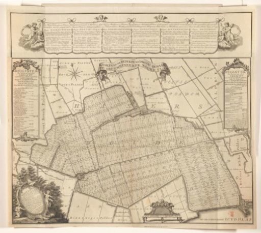
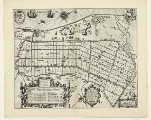
Land Division of the Zijpepolder, 1597
From the collection of Rijksmuseum, Amsterdam. Free to download, adapt and use — no permission needed.
About this work
Map showing the land division in the Zijpepolder, the poldering completed in 1597. Left the coast with Petten, bottom Schagen. Bottom cartouches with tables, time verse, the title and the scales. Top left the coat of arms of Holland at the place Petten.
Rijksmuseum, Amsterdam’s own descriptionCredit lineVerkaveling van de Zijpepolder, 1597. 1600. Baptista van Doetechum. Rijksmuseum, Amsterdam. Public domain.