Public domain
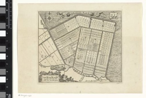
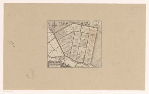
Map of the plots of the Wieringerwaard
From the collection of Rijksmuseum, Amsterdam. Free to download, adapt and use — no permission needed.
About this work
Map of the plots of the Wieringerwaard, as allocated on July 12, 1611. At the top center the title, to the right thereof the coat of arms of Wieringerwaard. Bottom left a scale bar: Zypsche dyck roeden of 600 int morgen.
Rijksmuseum, Amsterdam’s own descriptionCredit lineKaart van de kavels van de Wieringerwaard. c. 1623 - c. 1649. Gerard Coeck. Rijksmuseum, Amsterdam. Public domain.