Public domain
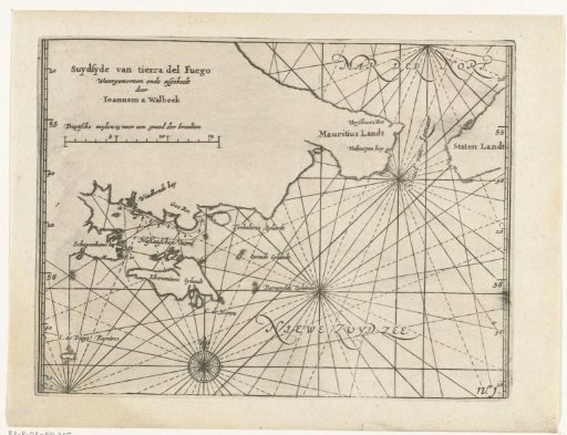
Map of the Strait of Le Maire, 1624
From the collection of Rijksmuseum, Amsterdam. Free to download, adapt and use — no permission needed.
About this work
Map of the southern tip of Tierra del Fuego with the Strait of Le Maire (Estrecho de Le Maire) between Mauritius Land and Staten Island (Isla de los Estados), 1624. Part of the illustrations in the report of the voyage around the world of the Nassau fleet under Jacques l'Heremiet, 1623-1626, No. 1.
Rijksmuseum, Amsterdam’s own descriptionCredit lineKaart van de Straat van Le Maire, 1624. 1644 - 1646. anonymous. Rijksmuseum, Amsterdam. Public domain.