Public domain
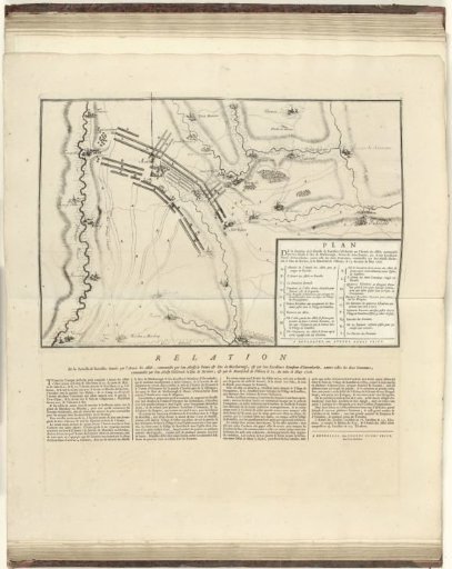
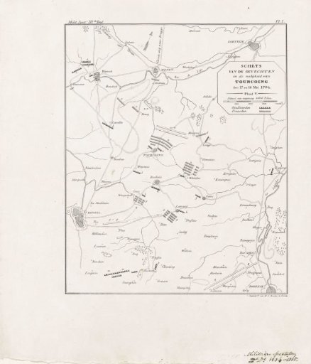
Map Showing the Positions at the Battle of Tourcoing, May 1794
From the collection of Rijksmuseum, Amsterdam. Free to download, adapt and use — no permission needed.
About this work
Map showing the positions of the Allied and French armies at Tourcoing between Kortrijk and Lille, 17-18 May 1794. Marked at the top: Milit. Spectr. IIIde Deel / Pl: I.
Rijksmuseum, Amsterdam’s own descriptionCredit lineKaart met de posities bij de slag bij Tourcoing, mei 1794. 1834 - 1835. Hilmar Johannes Backer, anonymous. Rijksmuseum, Amsterdam. Public domain.