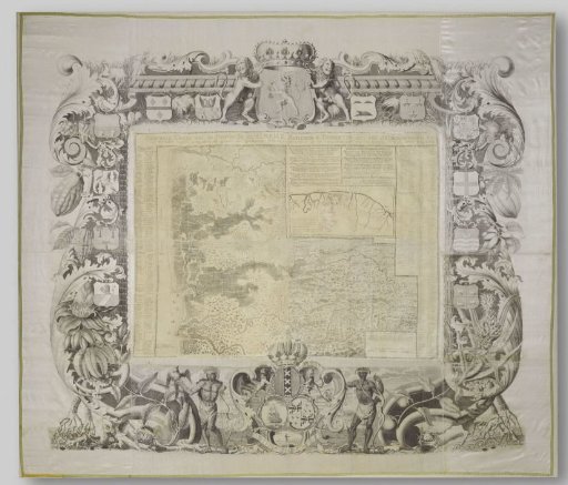
Map of Suriname
From the collection of Rijksmuseum, Amsterdam. Free to download, adapt and use — no permission needed.
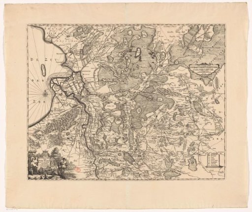
General Map of Surinam Province, by Alexander de Lavaux, 1737. Surinam in the first half of the 18th century. Sugar, coffee and cotton plantations are located along the rivers, used for transporting people and products. Military expeditions against runaway slaves - so-called bush negroes or marons - are shown: huts burning, people and soldiers running. The surveyor Alexander de Lavaux took part in a punitive expedition in 1731. He was commissioned by the Sociëteit van Suriname, which governed the colony, to draw this map. In the decorative margin: the arms of the Society, flanked by a slave and an Indian and the arms of the States General. The other emblems are those of the eleven directors and the secretary of the Society.
Rijksmuseum, Amsterdam’s own description