Public domain
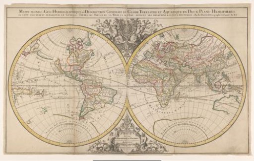
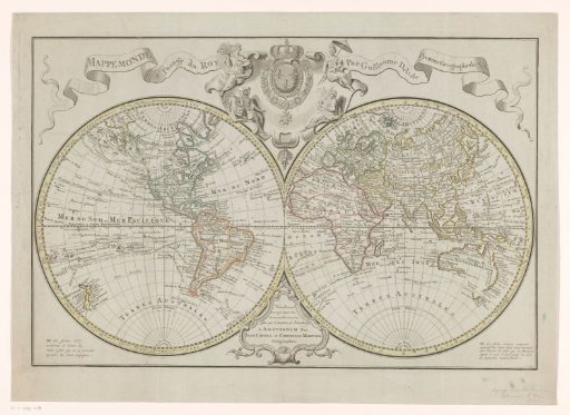
World Map, Divided into Maps of the Eastern and Western Hemispheres
From the collection of Rijksmuseum, Amsterdam. Free to download, adapt and use — no permission needed.
About this work
World map, divided into map of the eastern and western hemisphere. Above a banner with the title, in the center the coat of arms of the Kingdom of France with personifications of the four great continents around it. The map is provided with a coordinate net and a degree division along the edges.
Rijksmuseum, Amsterdam’s own descriptionCredit lineWereldkaart, verdeeld in kaart van het oostelijk- en het westelijk halfrond. 1721 - 1774. Johannes Condet. Rijksmuseum, Amsterdam. Public domain.