Public domain
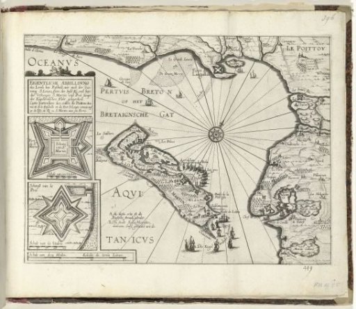
Map of the island of Ré near La Rochelle, ca. 1627
From the collection of Rijksmuseum, Amsterdam. Free to download, adapt and use — no permission needed.
About this work
Map of the island of Ré (Ile de Ré) off the French coast near La Rochelle, ca. 1627. Near the island the English fleet. To the left in two insets the forts of St. Martin and la Pré. Without a caption. Numbered in pen in the lower right: 419. The print is part of an album.
Rijksmuseum, Amsterdam’s own descriptionCredit lineKaart van het eiland Ré bij La Rochelle, ca. 1627. 1625 - 1627. Rijksmuseum, Amsterdam. Public domain.