Public domain
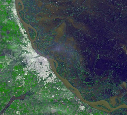
NASA Spacecraft Tracks Argentine Flooding
From the collection of NASA Image and Video Library. Free to download, adapt and use — no permission needed.
About this work
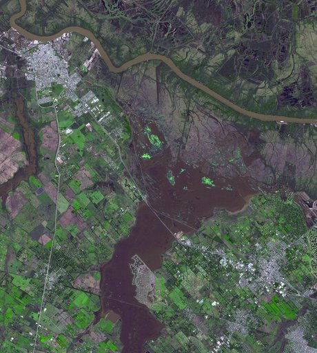
Northwest of Buenos Aires, Argentina, seven straight days of torrential rains of up to 16 inches 40 centimeters in August 2015 resulted in flooding between the cities of Escobar and Campana as seen by NASA Terra spacecraft. The flooding has since eased, allowing some evacuated residents of the 39 affected municipalities to return to their homes. The flooding was captured in this satellite image acquired Aug. 16, 2015, by the Advanced Spaceborne Thermal Emission and Reflection Radiometer (ASTER)
NASA Image and Video Library’s own descriptionCredit lineNASA Spacecraft Tracks Argentine Flooding. NASA/JPL, 2015-08-19. Public domain. ID: PIA19871.