Public domain
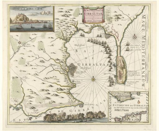
Map of Gibraltar, 1704
From the collection of Rijksmuseum, Amsterdam. Free to download, adapt and use — no permission needed.
About this work
Map of Gibraltar with the ships of the Allies before the harbor of Gibraltar, captured on 3 August 1704. In the upper left, an inset with a view of the Rock of Gibraltar; in the lower right, an inset with a map of Southern Spain and North Africa. At the bottom, a naval battle.
Rijksmuseum, Amsterdam’s own descriptionCredit lineKaart van Gibraltar, 1704. 1704. Rijksmuseum, Amsterdam. Public domain.